
Climbing Pico del Águila, Mexico
Embark on an exhilarating adventure just a stone's throw away from the bustling streets of Mexico City. Pico de Águila, a majestic mountain rising proudly in the State of Mexico, beckons outdoor enthusiasts and nature lovers alike. In this blog post, I will share my experience of climbing Pico de Águila in a day trip, immersing the reader in its natural beauty and breathtaking vistas. Standing tall at an impressive height of 3,900 meters (12,795 feet), is a majestic mountain. From a distance, Pico de Águila showcases a remarkable resemblance to an eagle.
This natural wonder offers a thrilling challenge for outdoor enthusiasts and adventurers seeking to conquer its lofty summit. With its rugged terrain and breathtaking vistas, the peak no doubt will enchant you and will take away unforgettable memories as you climb up to its lofty heights. Feel the gustatory bliss of imminent steaks when you experience this mountain's views or inebriate yourself with majestic vistas and fragrant scents of flowers as you dawdle on its scenic walks.
Location
Located within the Sierra de las Cruces mountain range, which is about 25km from metrobus station Perisur. Pico de Águila offers a perfect escape from the urban chaos, providing a refreshing respite in the lap of nature. With its accessibility and well-marked trails, it is an ideal destination for those seeking a challenging yet rewarding day hike.
The mountain peak is located about 25km from metrobus station Perisur.
Getting to the starting point
The route to the peak starts at a restaurant Cabaña La Palapa. To get there you'll need to take a few public transportation options. Begin by taking the Metrobus Red Line to Perisur station. From there, switch to a normal bus which is routed to Ajusco. Ask the driver to drop you off at the bus station “Lomas de Temecatl” and you'll need to take a taxi for the remainder of the journey. If the taxi driver isn't quite sure of the way, try helping him by showing them a map. Once you arrive at the restaurant, an employee showed the beginning of the hike and from this point, it will be a 2-3 hour hike.
Getting to top
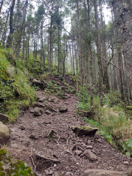
Road in the forest
The route begins with a journey through the forest, weaving through long grass and tall pines. Halfway, the environment changes to alpine meadows full of stones.
This is just the beginning of the adventure. The last 10 minutes require a careful ascent, navigated slowly and steadily over slippery stones. With each step, you edge closer to the summit
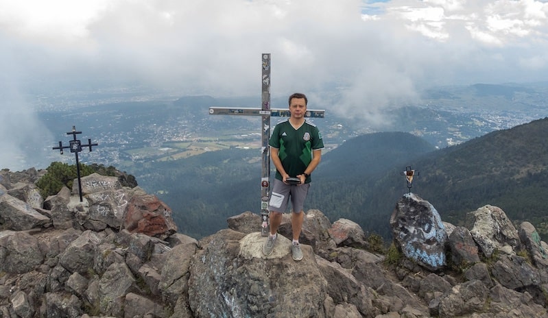
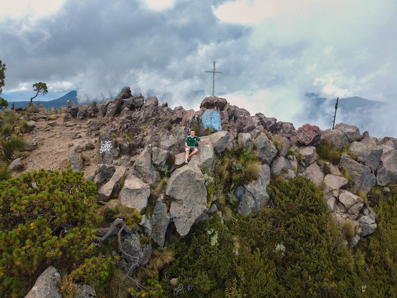
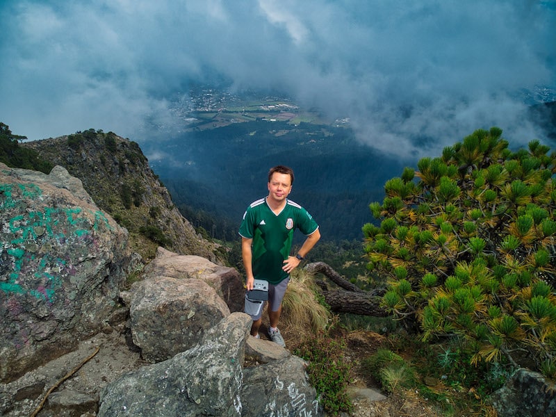
The summit
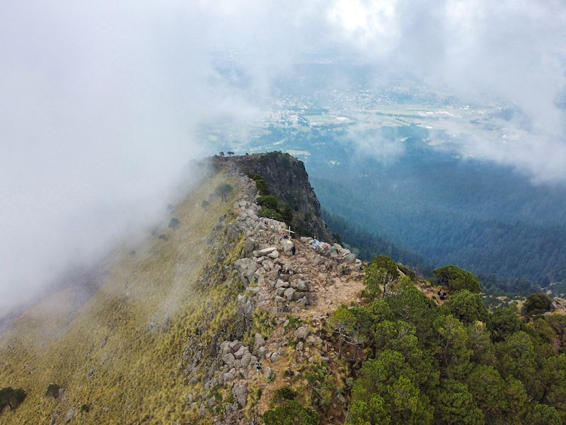
Drone pics from the summit
When you reach the top of the peak, an even better view of the majestic scenery is offered to you. The air is fresh and clean and filled with the heady aroma of nature. Take in the wide horizon – almost endless as it rolls off into the distance of Ajusco Park. It’s a phenomenal sight that will stay in your memory forever. On top, you’ll find two large crosses perfect for snapping and immortalizing this wonderful experience. Although luck may not be on your side when witnessing a completely clear sky; chances are you could be treated to a lovely vista of both Mexico City and Ajusco Park whose outlines twinkle on the horizon. There won’t be much else you remember about this powerful and majestic experience. Snap lots of photos - you’ll want them later!
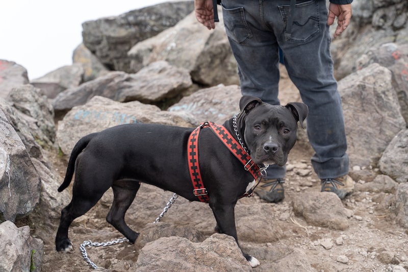
the dog
I spend about an hour and a half on the top. I flew the drone and made a lot of photos there. Some other tourists climb with a dog. So overall is not a hard hike and most people can do it. I really recommend it as a day trip while visiting Mexico City.

0 Comments