
Climbing Kilimanjaro
My group chose the six-day Machame variation, descending by the Mweka route. We started in rainforest at about 1,800 meters and climbed through several distinct landscapes before reaching snow near the summit.
The logistics were excellent. We had guides and porters, and while we walked, the team went ahead to prepare camp. Our tents were ready and food was being cooked when we arrived. I expected basic meals, so I was surprised by how good the food was.
I also decided to bring my drone with me because I imagined I would get some amazing aerial videos of Kilimanjaro. This turned out to be not my smartest decision :)
Day 1 – Machame Gate to Machame Camp
Distance: 11 km | Elevation: 1,800m → 2,835m | Walking time: 5–7 hours
We started at Machame Gate at around 1,800 meters. Everything there was completely green, with huge trees, wet air and dense tropical forest around us.
After registration at the gate and some final preparations, we started walking through the rainforest. The first day wasn’t particularly difficult, but it was long enough to understand that the next six days would involve a lot of great hiking. The trail was surrounded by dense vegetation, the air was humid and clouds sometimes moved directly through the forest. They say that you pass like 4 different natures while walking the volcano.
One of the first things I noticed was how fast the porters were. We were walking with relatively small backpacks, while they were carrying tents, food and equipment, but somehow they were still much faster than us. They would pass us somewhere on the trail and by the time we reached the camp everything was already prepared.
When we arrived at Machame Camp at 2,835 meters, our tents were standing and food was being cooked. We didn’t need to think about setting up camp or preparing dinner. We could just change clothes, eat and rest, which is a very comfortable type of mountaineering :)
Machame Camp was still surrounded by trees, although it was already noticeably colder than at the gate. The first day was finished, but there were still around 3,000 vertical meters between us and the summit.
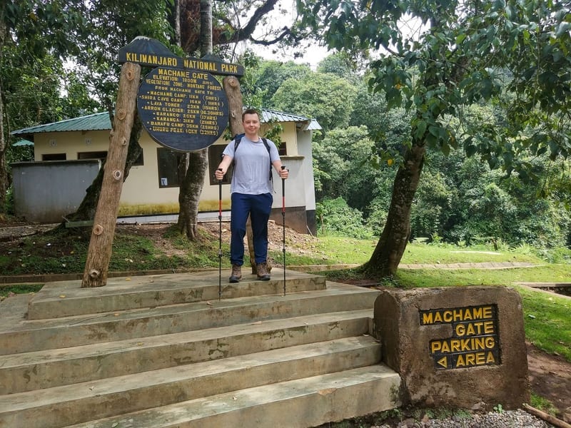
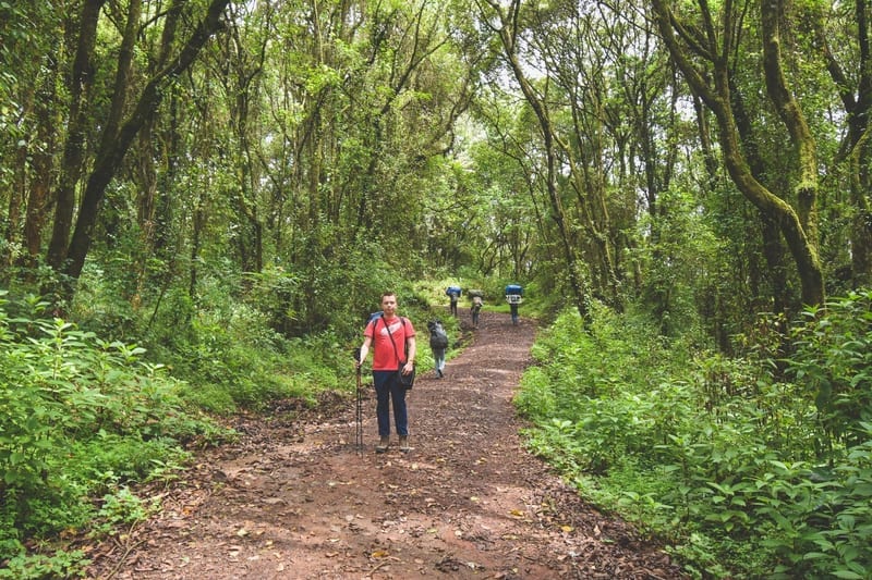
Machame Gate and the rainforest trail
Day 2 – Machame Camp to Shira Camp
Distance: 5–9 km | Elevation: 2,835m → 3,750m | Walking time: 4–6 hours
The landscape started changing very quickly on the second day. The tropical forest gradually disappeared, the trees became smaller and eventually the surroundings opened into moorland with rocks, bushes and much wider views. We were getting onto the Shira Plateau and for the first time it really started to feel like we were high in the mountains.
This was the only part of the trip where I managed to use my drone. I had brought it to Tanzania expecting to film regularly, but flying in Kilimanjaro National Park requires special authorization.
I walked some distance from camp so no one would see me flying it, but there wasn’t much to film and the connection kept dropping. I did get a few nice aerial shots around Shira Cave Camp, with small camps tucked between the mountains and the clouds. That was the beginning and end of my drone’s career on Kilimanjaro. After Shira, it was just expensive extra weight in my backpack :)
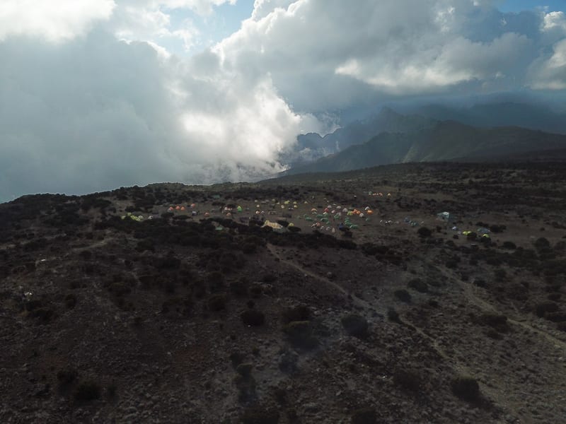
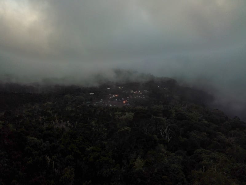
Shira Camp and surrounding camps from the air
We reached Shira Camp at around 3,750 meters. Once again, everything was already prepared when we arrived. The tent was ready, food was being cooked and there wasn’t much to do except eat, enjoy the views and get some rest before going even higher the next day.
Day 3 – Shira to Lava Tower and Barranco
Elevation: 3,750m → 4,600m → 3,960m | Walking time: 6–8 hours
We climbed to Lava Tower at about 4,600 meters, then descended to Barranco Camp at around 3,960 meters. The point was to spend time high and sleep lower. Above 4,000 meters, the landscape was mostly open slopes and volcanic rock.
Our guides kept reminding us to go “pole pole”—slowly, slowly. It made sense: there was no benefit to rushing when our bodies were adjusting to the altitude.
Barranco Camp sat below the wall we’d climb the next morning. It looked intimidating from camp, but we left that problem for tomorrow and focused on dinner and rest.
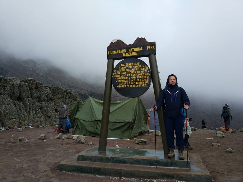
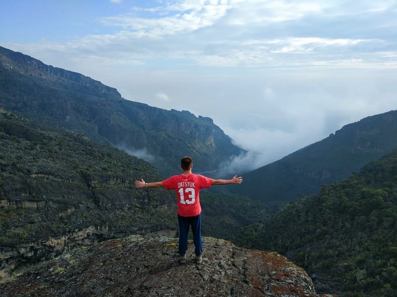
Lava Tower and the landscape on the way to Barranco
Day 4 – Barranco Wall to Barafu Camp
Elevation: approximately 3,960m → 4,600m | Walking time: 6–8 hours
Barranco Wall looked almost vertical from below, with a line of climbers winding up it. The climb was less daunting than it appeared. In places we used our hands to scramble over rocks, but it wasn’t technical climbing.
After the wall, we crossed Karanga Valley and continued to Barafu rather than staying overnight at Karanga. It made for a long day. Near Barafu, the vegetation had almost disappeared, and snow covered the dark rocks and tents.
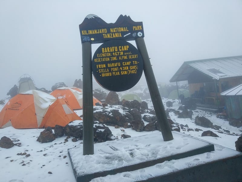
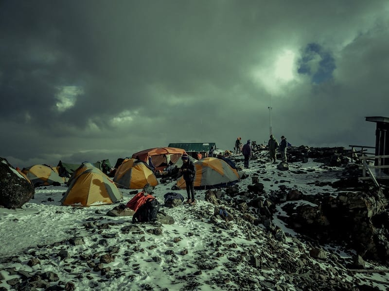
Snow and tents at Barafu Camp
We ate, laid out our gear and tried to sleep. We’d be getting up in the middle of the night for the summit push.
Day 5 – Summit Day
Elevation: Barafu ~4,600m → Uhuru Peak 5,895m → Mweka Camp ~3,000m | Total time: approximately 13–14 hours
We woke up in the middle of the night, and getting out of the sleeping bag was probably one of the least enjoyable moments of the whole trip :) It was dark and freezing outside, with snow around Barafu Camp, and now we had to start walking toward almost 6,000 meters.
We put on our warm clothes, prepared the headlamps and started climbing. In darkness you don’t really see the mountain around you. You mostly see a small area illuminated by your headlamp and the lights of other climbers slowly moving higher above.
I actually felt surprisingly good during most of the summit climb. I had expected the night to be much harder from the beginning, but my acclimatization seemed to be working well and I was moving quite strongly. I was among the first people from our group, and for most of the climb I didn’t have any significant problems with the altitude.
As we went higher, everybody naturally became slower. At this altitude there is no reason to hurry, so we just continued steadily toward the crater rim. For most of the night I still felt quite strong and thought I would reach the summit without too much difficulty.
The Last 200 Meters
Everything changed when we reached the crater area and only around 200 vertical meters remained to Uhuru Peak. Until that point I had felt good, but suddenly the altitude and accumulated fatigue started to catch up with me.
It wasn’t severe altitude sickness and I was still able to continue, but I could clearly feel that my body had much less energy. My pace became extremely slow. I would make one step, stop for a moment, then make another one and repeat the same process again and again.
The frustrating part was that the summit was already close. At normal altitude, another 200 vertical meters wouldn’t seem like much, but close to 5,900 meters even a short distance can take a lot of effort. There wasn’t anything complicated about the terrain; I simply didn’t have enough energy to walk normally anymore.
So I continued very slowly. There was no reason to rush because I knew I was going to make it. I just needed to keep moving, even if it was only one step at a time.
Uhuru Peak – 5,895m
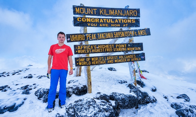
Eventually I reached Uhuru Peak at 5,895 meters, the highest point of Kilimanjaro and the highest point in Africa.
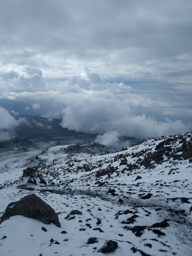
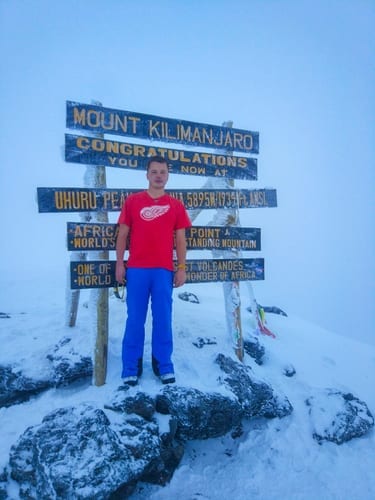
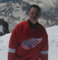
Uhuru Peak and the snowy view from the summit
I was tired but obviously very happy to be there. The last part had been much harder than I expected after feeling so good during most of the summit climb, and reaching the sign at Uhuru Peak was a big relief.
I carried the drone all the way to Uhuru Peak, but between the authorization rules and my exhaustion, there was no chance I was going to fly it. I simply didn’t have enough energy or interest to take it out of the backpack, prepare everything and start flying. At that moment I was much more interested in taking a few photos, enjoying the summit and going down :)
The rest of our group also made it to Uhuru Peak, so everybody successfully reached the summit. I had arrived among the earlier people and started descending before some of the others, which meant I was also back at camp much earlier.
The Long Descent to Mweka
The summit wasn’t the end of the day: we still had to descend to Mweka Camp, around 3,000 meters. I felt better as we lost altitude, and the weakness from the final ascent gradually passed. After hours of climbing, it was a relief to sit down, eat and stop moving. Everyone in our group made it back safely.
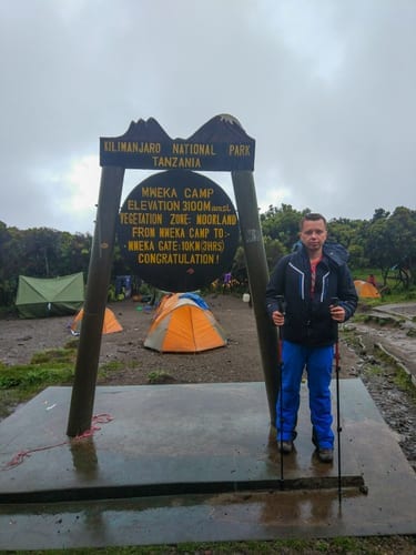
At Mweka Camp after the long descent
Day 6 – Mweka Camp to Mweka Gate
Elevation: approximately 3,000m → 1,640m | Walking time: 3–4 hours
The final walk was easier. As we descended, the landscape turned from bushes to forest. A day after standing near 5,900 meters in snow, we were back among humid tropical vegetation.
We reached Mweka Gate at about 1,640 meters, where the trek ended. After six days in tents, a shower and a proper bed sounded very good.
Final Thoughts
The Machame route is a trek rather than a technical climb: I didn’t need ropes or climbing skills. The challenge was doing that walking above 5,000 meters. I felt strong for most of summit night, then slowed to one step at a time near the top.
The guides and porters made the logistics smooth, and the meals were far better than I’d expected. Our whole group reached Uhuru Peak, crossing rainforest, moorland, volcanic terrain and snow on the way up, then descending through Mweka.
I carried my drone almost the entire way to Africa’s highest point and flew it once. For the rest of the trek, it was an expensive rock in my backpack.
0 Comments